
Data and service provider Searcher has partnered with Oman’s Ministry of Energy and Minerals (MEM) to acquire new seismic surveys and reprocess legacy seismic data both offshore and onshore Oman.
“Our priority is to focus on the exciting offshore basins where we see significant prospectivity,” said Neil Hodgson, Searcher’s vice president for geoscience. “Together with MEM, we will reprocess legacy data and acquire new seismic to reveal new insights into the hydrocarbon system and bring new investors to this oil-rich region.”
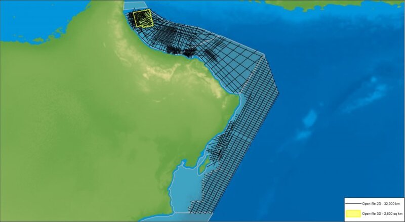
Reprocessing of the offshore legacy data in the Sea of Oman has begun. Improving the imaging of the geology offshore Oman involves both resolving uncertainties in the thrusts and fold belt plays and imaging the stratigraphy below the decollement surface. These insights are revealing oil prospectivity with unexplored yet significant resource potential. Searcher said in a press release that the whole 2D and 3D data set will be reprocessed in addition to the acquisition of new 2D and 3D seismic in 2022 and 2023.
The offshore Oman 2D and 3D rectification project is already complete and consists of 32,000 km of 2D and 2,500 km2 of 3D legacy data, which has been rectified using Searcher’s post-stack reprocessing method. The method resolves issues with navigation, metadata, amplitude, and phase and time shifts. The offshore rectified Oman 2D and 3D surveys are available through Searcher’s on-demand platform, sAIsmic, which hosts global rectified seismic data as a subscription service.