
Understanding the effect of microporosity on reservoir quality and predicting the spatial distribution of microporosity at the reservoir scale accurately is required to improve the recovery of remaining hydrocarbons from reservoirs. Using an integrated data-analysis approach applied to multiscale geological and geophysical data sets from micrometer-scale scanning-electron-microscope (SEM) imagery to decameter-scale seismic data, the authors predict the distribution of microporosity at the reservoir gridblock scale. The proposed methodology is applied in the complete paper to the Arab-D reservoir equivalent outcrop data from the Upper Jubaila formation in Saudi Arabia.
Methodology
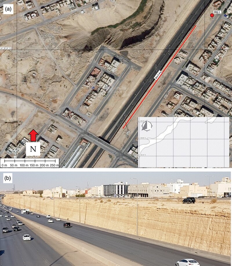
This methodology is tested at an 800-m-long roadcut along the Riyadh-Mecca Highway in Saudi Arabia, stratigraphically equivalent to the Upper Jubaila Formation in the subsurface (Fig. 1 above). A 35-m-long core was drilled from the top of the same roadcut (dubbed the DQ-1 well), from which 106 cylindrical horizontal core plugs were obtained, drilled with an average spacing of 30 cm.