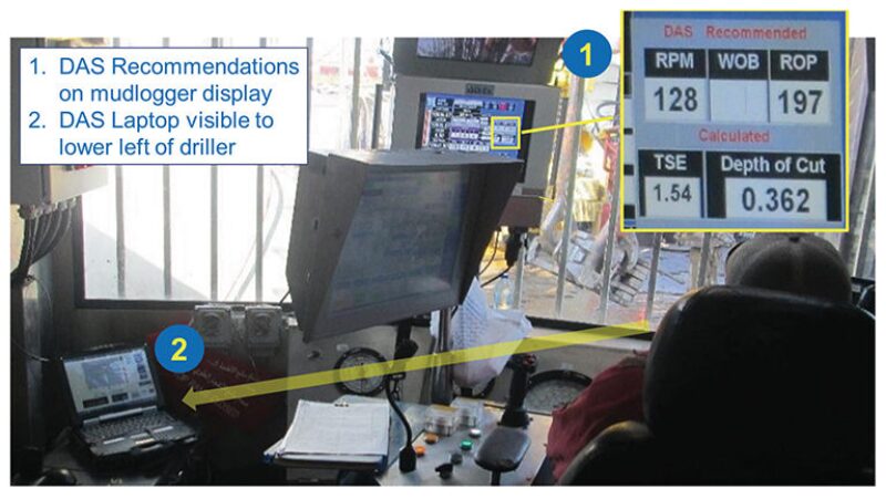
A real-time drilling-data analysis and recommendation system that leverages surface drilling data was deployed in a lateral section of a well from an artificial island in Abu Dhabi. A key objective of this technology was to provide the driller with an easy-to-use display of a novel drilling-performance map. This paper presents data from the demonstration run, illustrates the features of this technology, and provides general observations on optimization of drilling parameters in this hole section.
Background
A research prototype drilling advisory system (DAS) was set up on an island rig with a wellsite information transfer specification (WITS) data feed from the mudlogger cabin over a fiber-to-serial cable to the computer in the driller’s cabin.
The DAS helps the driller make decisions for managing controllable drilling parameters to enable a high rate of penetration (ROP) and low vibrations. The system uses surface data only (i.e., data obtained from sensors instrumented on surface equipment) from the mud logger.


