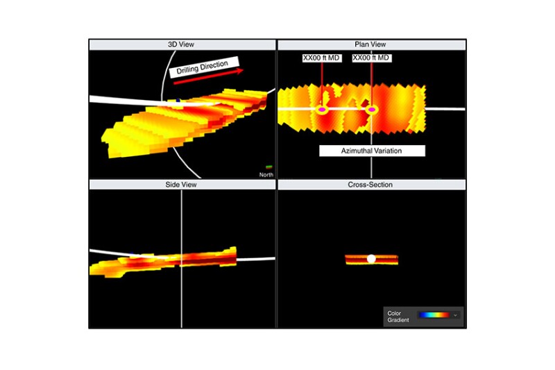
The use of modern ultradeep azimuthal resistivity (UDAR) tools, along with other logging-while-drilling (LWD) sensors, increases horizontal well‑placement efficiency, improving net-to-gross (NTG) and maximizing reservoir contact. The depth of investigation (DOI) of electromagnetic (EM) resistivity-based technologies depends on multiple factors. The performance of EM resistivity tools in very low-resistivity formations has remained a challenge, limiting the signal propagation and, thus, the DOI. The complete paper presents a novel workflow for using EM resistivity-based reservoir-mapping LWD technologies for successful well placement and multilayer mapping in very‑low‑resistivity, low-contrast, and thinly laminated clastic reservoirs.
Introduction
One of the main challenges for successful well‑placement operations is the ability to resolve boundaries that are further away from the horizontal wellbore or that feature a poor contrast in resistivity values from surrounding layers. During the past two decades, azimuthal resistivity tools designs and EM signal-inversion algorithms have evolved to address this challenge.


