
DSDE: In Practice
-
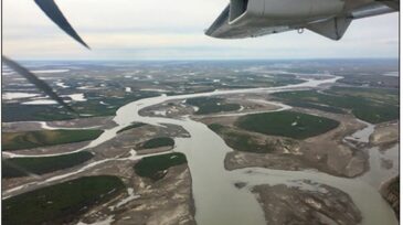
 Many forms of remote sensing imagery can be used, along with data sets and the resultant products, to improve the efficiency and safety of upstream oil and gas operations on the North Slope of Alaska.
 -
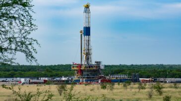
This paper describes the development and field trials of a cloud-connected, wireless intelligent completion system that enables long-term monitoring and interval control to enhance production management by connecting the user wirelessly from the desktop to downhole inflow-control valves.
-
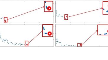
This paper details how artificial intelligence was used to capture analog field-gauge data with a dramatic reduction of cost and an increase in reliability.
-
This paper investigates the most important independent variables, including petrophysics and completion parameters, to estimate ultimate recovery with a machine-learning algorithm. A novel machine-learning model based on random forest regression is introduced to predict estimated ultimate recovery.
-
The December issue of the peer-reviewed SPE Journal includes a spotlight section on data analytics, presenting paper SPE 195698, “Prediction of Shale-Gas Production at Duvernay Formation Using Deep-Learning Algorithm.”
-
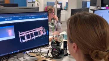
Rovco’s stereo camera technology system sends images and 3D models of assets from the seabed to computer browsers in any location, offering users instantaneous access to information during inspection or construction.
-
Using deep-learning and computer-vision techniques, the software recognizes all instances of specific instruments, valves, lines, and other features in a P&I diagram in seconds.
-
The company is relying on DevOps and agile to hit a bold growth goal by 2025: doubling profits without changing prices.
-
Microsoft announced that it will open an AI Center of Excellence for Energy in the United Arab Emirates—a global first for the company—to empower organizations in the industry in accelerating digital transformation and equipping their workforce with AI skills.
-
ExxonMobil is expanding its Baton Rouge polyolefins plant in a $500 million investment and tapped King Crow Studios, along with 3D Media and Pixel Dash, for the training effort—a sign of an emerging collaboration in Louisiana between tech-driven startups and the industrial sector.


Trending Now on DSDE


Stay Connected
Don't miss out on the latest technology delivered to your email every 2 weeks. Sign up for the DSDE newsletter.