
TDI-Brooks completed two geotechnical support projects for DenAr Ocean Engineering SA, headquartered in Istanbul, Turkey, for the state-owned Turkish Petroleum Corp.'s (TPAO) Sakarya gasfield pipeline route investigation and site survey project.
The first deepwater gasfield discovery in Turkey, the Sakarya is estimated to hold 540 Bcm of gas reserves. First gas is expected in 2023. The field development plan includes the installation of a subsea gas production system, construction of a gas processing terminal in Filyos, Turkey, and laying a 170-km-long subsea pipeline to export gas from the field to the gas terminal.
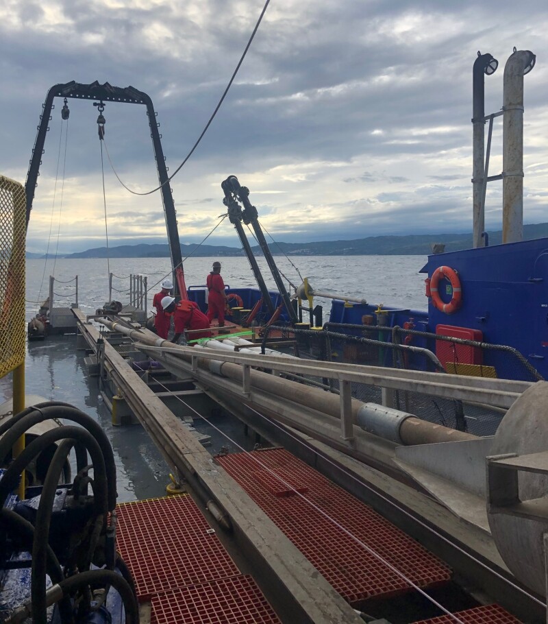
During the first cruise in April 2021, TDI-Brooks acquired approximately 30 gravity CPTs (gCPTs) with its memory standard 15-cm2 CPT cones. The CPT cones were fitted onto DenAr’s piston core rigs. On box cores, the research and service company based in College Station, Texas, provided its cyclic T-Bars using Den-Ar’s provided box cores. This project was conducted on the Denar 2 vessel over a period of 71 days in the Turkish portion of the Black Sea.
The purpose of the Gravity CPT Stinger tool is to transport a piezocone penetrometer down to the seabed or lakebed to gather dynamic PCPT cone data from the mudline to typically 6 to 10 m or even 20+ m below the mudline.
In addition to its 800-kg driving head with lifting bale and coupling, the rig comprises a self-contained PCPT cone penetrometer that measures tip resistance, sleeve friction, and pore pressure using standard ASTM cone protocols. The gCPT system is deployed using the same winch, A-frame, and process as for piston coring. When just above mudline, the tool is triggered like a piston corer to ballistically insert itself into the soil. Once the cone insertion into the soil is complete (less than 3 sec after trigger), the system is immediately retracted from the seabed and retrieved to the deck. Cone data are downloaded from the probe for evaluation and analysis. The tool is readied for the next deployment, typically in less than 5 minutes, making numerous measurements per day feasible, depending only on water depth and winch speed. The maximum water depth for the gCPT is 4000 m.
The TDI-Brooks Auto T-Bar instrument measures the progressive resistance of a soil column to a cylindrical rod (shaped as an upside-down T) as it is pushed down the soil column at a constant rate. Operation consists of mounting the instrument onto a box corer containing an undisturbed seabed soil sample, connecting the instrument to a source of compressed air, and starting the automatic advance of the T-Bar into the soil sample. The resistance of the soil is automatically logged during the downward advance until the bottom of the soil sample is reached by the T-bar. The instrument then reverses T-bar movement and logs the soil resistance generated during the upward, retracing return of the T-bar back up to any desired soil depth or to the surface. This sequence of a downward stroke followed by upward re-trace through the failed soil can be immediately repeated as many times as desired. Sets of 10 such cyclic T-bar tests are typical in box cores.
For the second cruise on the project in July 2021, TDI-Brooks mobilized its research vessel, the R/V Proteus, to the Black Sea for “heavy” geotechnical coring/CPT acquisition. This geotechnical program acquired several dozen 20-m jumbo piston cores, 40-m CPT-Stingers, and up to 40-m SB Shelby-tube Stinger-Samplers. The Proteus is outfitted with TDI-Brooks’ complete geotechnical tool kit including a suite of innovative geotechnical tools for soil sampling and CPT measurement. The vessel also has a Kongsberg EM-710 (1x1) hull-mounted multibeam for surveys to ~2500 m water depth for performing surface geochemical “seep-hunting” and seabed heat flow surveys.