Reservoir characterization
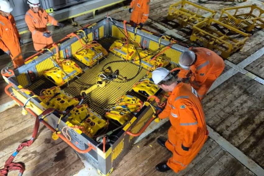
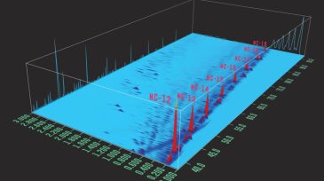
The technology has passed its first phase of qualification, with 84 nodes placed on the seafloor at a depth of 2,000 m to acquire 4D seismic data in the pre-salt Santos Basin.

Xu outlines the thinking and theories that led his team to six world-class oil discoveries that total more than 100 million tons of proven geological reserves since 2021.

This case study from SLB and offshore producer PRIO describes the longest openhole section in Latin America with the highest extended-reach drilling ratio in Brazil’s history.
-
 This paper presents a coupled 3D fluid-flow and geomechanics simulator developed to model induced seismicity resulting from wastewater injection.
 -
Fluid saturation isn't what it used to be when it comes to unconventional reservoirs. Our guest is among those sharing new research to discuss the shale sector’s changing perspectives on the importance of mobile hydrocarbons vs. immobile hydrocarbons.
-
Knowing which horizon crude oil flows from and in what proportions has been a major challenge for shale producers. Increasingly, they are turning to new technology to find the answer.
-
The types of advancements made in real-time drilling data acquisition and processing are now on the doorstep of the North American completions sector. Technology developers are banding together under the umbrella of “coopetition” in a bid to change the way producers fracture tight reservoirs.
-
Applications development in reservoir geomechanics has grown exponentially in recent years, taking advantage of significant computer breakthroughs. Data integration and multidisciplinary strategies are key to advancing integrated reservoir geomechanics capabilities.
-
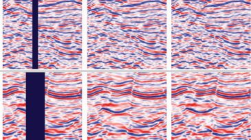
The authors present a novel data-driven tool for fast fracture identification in post-stack seismic data sets.
-
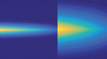
Seismic imaging provides vital tools for the exploration of potential hydrocarbon reserves and subsequent production-planning activities. The acquisition of high-resolution, regularly sampled seismic data may be hindered by physical or financial constraints.
-
ConocoPhillips has pulled out of the much-hyped Louisiana Austin Chalk play after the company’s test wells yielded a gusher of water. Meanwhile, an Australian operator flying under the radar continues to pursue the adjacent-but-even-more-challenging Tuscaloosa Marine Shale.
-
In this paper, the authors discuss the characterization process for GR tools and how they behave in boreholes different from the one used in the University of Houston (UH) GR characterization pit.
-
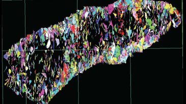
This paper discusses a study undertaken to gain better understanding of nuclear magnetic resonance (NMR) characteristics of volcanic reservoirs with different lithologies.